I came across a nice 3-part series of videos by Sebastian Wöber that provide some tips about getting better aerial footage with drones and working with drone footage during editing. Wöber made these videos because he said that although there were a lot of technical, how-to tutorials out there, none showed how to get really cinematic-quality footage with a drone.
If you are thinking about buying a drone for filmmaking or you already have one and wish to improve the quality of your footage, these videos may help.
Wöber used a DJI Inspire 1 to make his points. Some of the topics covered in part 1 include safety considerations, details about the Inspire 1, setting up a shot (perspectives), and lighting considerations. In parts 2 and 3, he goes into more detail about the limitations of the camera in the Inspire 1 and using After Effects to make corrections during editing (these tips are a bit more technical and require more experience with professional filmmaking and editing techniques).
Overall, though, his suggestions are good for those videographers interested in getting more cinematic aerial footage of landscapes. If you are an amateur videographer, you will find part 1 the most useful, which I’ve embedded below. You can find all three videos and more information on the Cinema5D website.
As GoPro Hero cameras and other POV (Point of View) cameras become more popular, users increasingly need quick and easy ways to edit the footage. For example, drone footage shot with a GoPro (or other camera) may produce long sequences composed of different views, perspectives, and subjects. If you need only one short clip from that footage for a video project or to send to someone, how can you easily and quickly extract that particular clip from a 15-minute long reel?
You could import the footage into a movie-editing program and extract the clip that way. But what if you haven’t mastered iMovie or GoPro Studio or just don’t want to fool with a movie-editing program to do some simple edits on your footage? One option is QuickTime, which is a movie player that comes bundled with Mac computers (there is also a Windows version). In addition to playing video files, QuickTime has some basic editing tools that can be used to trim, split, and combine video clips.
In the following video tutorial, I show how to use QuickTime to make basic edits on some GoPro drone footage. Although I’m focusing on GoPro to illustrate QuickTime’s editing tools, this application can be used with any video file (e.g., .mov, .mp4, .m4v, H.264) or audio file (e.g., .wav, .MP3) that QuickTime can open and play.
The use of Unmanned Aerial Vehicles (UAVs), or drones as they are popularly called, for aerial photography has increased dramatically in recent years. This guest post by Thomas Foster provides a brief background and a few basic instructions in the use of UAVs to conduct aerial photography.
Aerial photography is a popular type of photography, which can be done using various approaches. One of the easiest methods is to photograph from the top of a tall building, mountain, or other place that provides a good vantage point. An even better way is to hire a balloon or helicopter. However, this latter approach is expensive and may not reach all the areas you need to photograph.
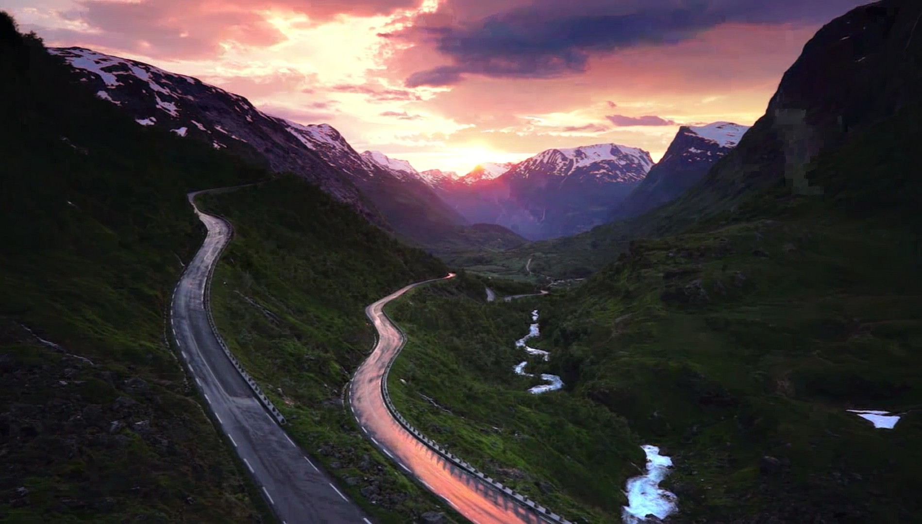
Photo of Norwegian landscape. Taken in May 2014.
With the development of small UAVs (Unmanned Aerial Vehicles), commonly called “drones”, photographers have a new and more flexible way to capture aerial photos. These aircraft can be operated by remote control to fly according to the wishes of the pilot on the ground. Drone technology has enabled photographers to reach even more areas and make even better photos than in the past. Their small size means that photographers can more easily access specific spots from where they can get a good view of their subjects. Their cost can vary a lot depending on quality. The cheapest drones (with camera) cost $100 or more, but higher quality models may exceed a few thousand dollars.
A brief history of aerial photography
The first known aerial photograph was taken of a French village in 1858 from a balloon piloted by French photographer, Gaspar Felix Tournachon, known under the pseudonym “Nadar”. The technology was not well developed—for example, Tournachon had to develop his photographs in the air and needed a darkroom in the basket of the balloon. This procedure was difficult and as a result, the quality suffered.
Other artists of that time copied his technique, but the results were generally not much better. Even so, these early aerial photographers captured some important landscapes and events of their times (see image below) and paved the way for further advances.
Photo of San Francisco after 1906 earthquake. Taken by George R. Lawrence in 1906 (public domain)
During the First World War, aerial photography advanced quite a bit, driven by the need of warring countries to determine the enemy’s battle positions. Over half a million aerial pictures were taken during the war. After the war, aerial photography was used for commercial purposes. Companies needed aerial photos of cities and landscapes, for example. Another advance occurred in World War 2, again driven by the need to record the enemy’s front lines. After the war, aerial photography continued to advance and eventually developed into the modern technology we know today.
There are many things that you should be careful about as an aerial photographer. Most of all, it is important to respect the rules of flying, listed below and also available on the FAA (Federal Aviation Administration) website:
Fly below 400 feet and remain clear of surrounding obstacles
Keep the aircraft within visual line of sight at all times
Remain well clear of and do not interfere with manned aircraft operations
Don’t fly within 5 miles of an airport unless you contact the airport and control tower before flying
Don’t fly near people or stadiums
Don’t fly an aircraft that weighs more than 55 lbs
Don’t be careless or reckless with your unmanned aircraft – you could be fined for endangering people or other aircraft
Those rules apply in the USA where it’s also necessary to register your drone if it is more than 0.55 lbs. (250 g) and less than 55 lbs. (25 kg) (larger aircraft require a different procedure). In other countries, there are different rules, although many are similar to those listed above. In general, you should ensure you don’t endanger anybody or their property while using drones to capture aerial images. Another important point to consider is that when you are recording footage of private property, you need the permission of the property owner if you want to publish the footage anywhere.
About the camera
Camera quality is important in aerial photography, and there are a few points you should consider when buying a camera. The most important features are the ISO settings, which determine the camera’s ability to adjust to the light conditions, and the image resolution. Other important features to look for when buying a camera are the field of view (FOV) and the weight of the camera. Many quadcopters (and drones) offer a so-called FPV (First Person View) system. This option allows the drone-mounted camera to transmit video in real time, making the experience of flying the same as if you were in the aircraft. The camera quality of FPV is usually not great because the transmitter cannot send a high quality picture in real time. In other words, this type of camera provides a lower quality image, which may be unacceptable to some users. To compensate, many photographers attach an extra camera to the FPV drones to enhance the flying experience while simultaneously recording a high quality image. This combination provides a preview of the scene and gives more control to the pilot in deciding when and where to take a photo.
Some aerial photography tips
When you are finally recording aerial images, you want to ensure that they are of the best quality possible. Here are some tips to improve the quality of your pictures;
Before you begin, think about what you are trying to capture and how you are trying to capture it. Then decide on a plan of action. For example, think about how much you need to zoom in relation to how far away from the target you are. At a minimum, make a list of shots you wish to take and from what perspective and altitude. By having a clear plan prepared beforehand, you will save a lot of time and effort in the field.
Watch the weather forecast because unfavorable conditions such as strong winds can ruin your photos. The position of the sun is also important because of how it affects lighting. Keep track of the sun in relation to the drone’s flight path and adjust accordingly.
Always adjust the camera settings prior to a flight and select the proper lens for the situation. For example, sometimes it is beneficial to use a short lens when you plan to make pictures of a large area and you want to make it look bigger. Long lenses are useful if you are focusing on smaller objects. By preparing the camera properly for lighting and other conditions, you will be more likely to get the desired image.
Try experimenting with moving the camera during flight. Some drones have a movable gimbal, which is a great feature. For example, you can adjust the point of view when you are at different heights. With this approach, you can better synchronize flying and taking photos.
As mentioned above, some drones have FPV mode. If your drone has this option, give it a try. You may find that this mode makes aerial photography easier and also improves the quality of your images.
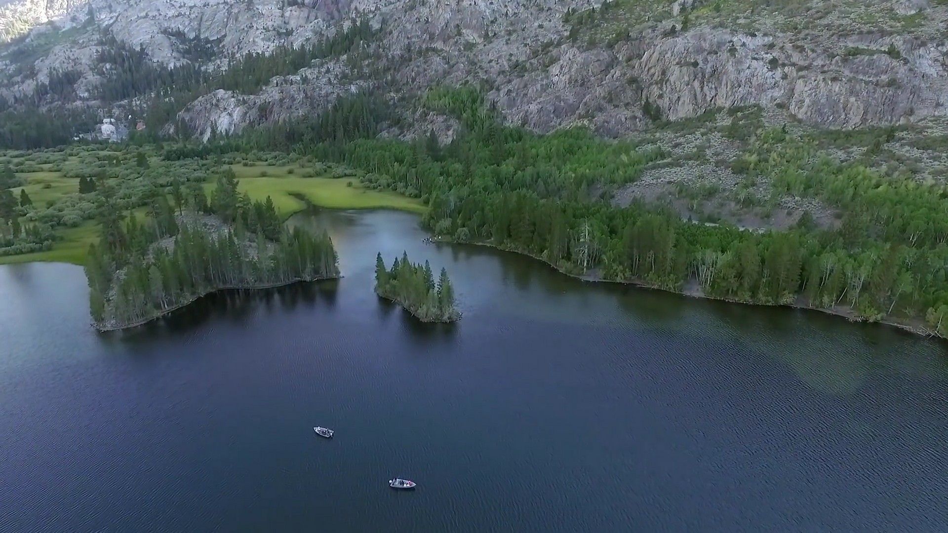
Photo of Norwegian lake. Taken in May 2014.
About the author:
Thomas Foster is a quadcopter enthusiast and a big fan of quadcopters with cameras, which he uses to record aerial photographs and videos. He is also an active observer of the changes in drone industry. In addition, he hosts a site about best quadcopters with camera where he compares best quadcopters currently on the market. You can also find him on Twitter.
When was the last time you had fun doing field research? What’s that you say? Not ever? Then you probably haven’t tried using a quadcopter yet.
A quadcopter is a remotely-operated, miniature helicopter that is lifted and propelled by four rotors. These unmanned aerial vehicles (UAVs), commonly called “drones”, can carry high-definition cameras that are able to capture spectacular aerial video at a fraction of the cost of a full-sized helicopter rental. Quadcopters are increasingly used by business owners such as sports photographers, wildlife photographers, hunters (feral pig spotting), travel agents, and real estate agents (although commercial use of these aircraft was ruled illegal by the FAA in the US). Scientists are just getting started finding ways to use UAVs in field research such as these agriculture researchers.
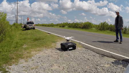
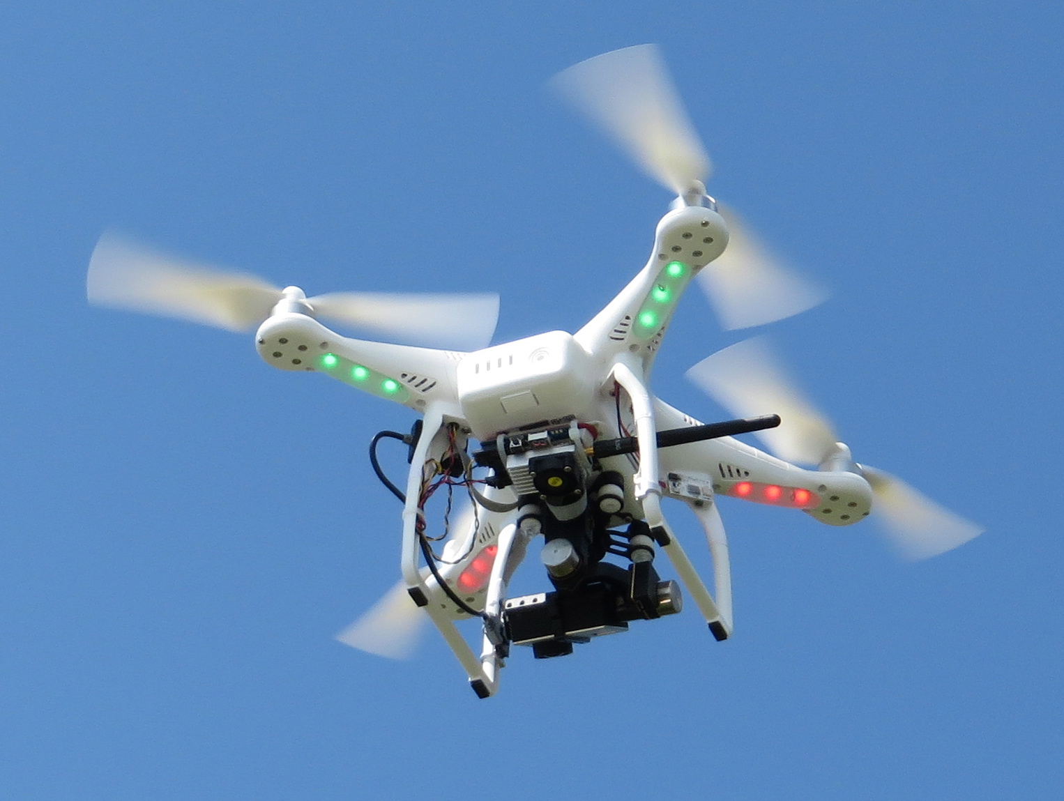
Last week, I had an opportunity to go out with some colleagues who were testing one, specifically a Phantom II sold by DJI. As you will see in the video, my colleagues are using the quadcopter to acquire low-altitude video of some coastal ecosystems, which can often be remote and/or difficult to traverse on foot.
I drove with two colleagues to Golden Meadow, Louisiana where we met Dr. Mark Byrnes of Applied Coastal Research and Engineering and his son Dylan, who is the expert at piloting their quadcopter. This group has been studying some of the salt marshes in south Louisiana and want to use the quadcopter to assess vegetative recovery from disturbance as well as changes in the geomorphology of the shorelines. We convened for dinner at a local restaurant and discussed the plan for the following day. After sampling the local cuisine (grilled shrimp and sweet potato fries for me), we headed to the hotel where we fired up the quadcopter in the hotel parking lot to check that all systems were functioning properly. Dylan flew the quadcopter, with its lights flashing red and green, around the hotel and periodically up to a couple hundred feet overhead. Before long, we had drawn a crowd of hotel employees and guests. The next morning, we drove to where the study site was located and spent several hours flying the Phantom II around the area. The main objective was to get an idea of how the quadcopter would perform and to begin working out a survey protocol to use on future field trips.
Here’s a video showing some of the highlights:
The following is a more detailed description of the Phantom II that we tested and how it performed.
Description. The Phantom II is a radio-controlled quadcopter (made by DJI) that is outfitted with an HD camera. It is relatively small and light and has four rotors. There are also running lights that flash red and green. The system that my colleagues purchased came with a GoPro Hero 3+ (Black Edition) camera, which was attached to the quadcopter via a special gimbal. The gimbal is essential for steady video; earlier versions did not have a gimbal, and the resultant footage was quite jerky. There are also cinema-grade gimbals that can be purchased for more serious filming. The power source is a lithium “smart” battery with four LED lights to indicate charge status; it slides into a slot on the side of the quadcopter. One battery charge is supposed to last 20 to 25 minutes, although it’s recommended to stop flying when 15% charge is reached (our flights did not go longer than 17 min). There were two extra batteries, so we had a total of about 50 minutes of flight time initially; we were able to recharge the batteries for the afternoon flights when we stopped for lunch at a local restaurant.
The quadcopter is operated with a remote control console, which has altitude and yaw movement knobs that are operated with thumb motions. The viewing position (oblique/vertical) of the camera is operated via a lever on the console. Attached to the console is a viewing monitor that shows real-time video from the camera as well as flight information such as altitude, GPS position, distance. The Phantom also can be used with iOS devices (iPhone, iPad) to view flights and to control the camera. Manual navigation can be accomplished by watching the quadcopter (if within sight of the operator) or the monitor. The GoPro Hero 3+ camera can be set to shoot “narrow” (90 degrees), “medium” (127 degrees), or “wide” (170 degrees) fields of view at different frame rates (e.g., 24, 30 or 60 fps) and resolutions (e.g, 1080p or 2.7k). The camera, set to video mode, is turned on at the beginning of the flight and runs until turned off at the end of the flight. The GoPro will also shoot high-resolution, still images, but requires a way to control the shutter (the system we tested did not have this). Another option, which we did not test, is to use the time-lapse feature on the GoPro to shoot a series of still images. Images and video footage are stored on a micro SD card and transferred to computer with a card reader (or by connecting the GoPro via cable).
There are other Phantom packages that can be seen on the DJI website, some of which are equipped with a different type of camera and gimbal system (Phantom II Vision+).
Cost and Performance. This product is not a toy–at a cost between $959 and $1,299 (depending on model), not counting accessories such as extra batteries. However, it is affordable for the professional or serious photography enthusiast. If you already have a GoPro camera, you can save a few dollars by purchasing just the quadcopter and a gimbal. Extra batteries are a must–20 minutes is simply not enough time to do much, and charging takes up to an hour. The quadcopter body is constructed of plastic and is lightweight, weighing in at 1030 grams (2.3 lbs), which means that if it crashes into a building or parking lot surface, it may suffer some serious damage. The rotor blades are the parts that are easiest to damage, but are easily replaced. Neither the quadcopter or the camera is waterproof (unless the GoPro underwater housing is used), so using it in the rain or landing it on wet ground is probably not a good idea (although some people have apparently flown it in light rain or snow). Flying in a marine environment will expose both aircraft and camera to salt spray and high humidity, which will likely take a toll over time.
Even though the Phantom II is not a toy, it is loads of fun. We had a blast watching it fly around doing different maneuvers that one might perform in a field survey. The Phantom II could hover and remain remarkably stable even in moderate wind. I was blown away by the fantastic video this quadcopter and GoPro combo could capture. The gliding footage looked like it had been shot from a crane dolly or some other expensive filming set-up. Comparable footage shot from a helicopter using a gimbal-mounted camera would cost you thousands of dollars per day—little wonder that filmmakers and wildlife photographers are adopting it. The Phantom II can be set up to fly a GPS path on a map, although we did not do this; instead, transects were flown manually using visual cues (flags) and onscreen video as a guide.
Learning curve. I did not fly the Phantom II, but could see that one could learn fairly quickly. The controls are simple and if you get into difficulty, releasing the sticks will cause the quadcopter to stop moving and hover in place until you get your bearings again. However, people have crashed these things, especially when in tight quarters…near trees or buildings, for example. We were out in the open and only had a few power lines to worry about. It’s also possible to navigate using only the monitor and live feed from the camera, although it’s easy to get confused about direction when you can no longer see the aircraft in the sky. Some experts recommend learning to fly an inexpensive UAV before trying to operate something expensive like the Phantom II. Another option is to get a few lessons from an experienced Phantom II pilot before striking out on your own. Also, it seems obvious that a beginner should learn somewhere with wide open spaces–a park or field–where there is plenty of room. I’ve watched several videos of first flights attempted in an urban setting with numerous obstacles such as buildings, power lines, signs, trees, and people….quite a number of these end with a crash.
Fly responsibly. It became clear to me that a UAV should not be flown in a populated area by an inexperienced pilot, and even with an experienced pilot there is still the possibility of a crash due to mechanical failure or loss of communication with the aircraft. People and property have been struck by them, so liability is something to keep in mind. Stories of flyaway quadcopters abound on the Internet; there is even a Facebook site providing psychological support for folks whose aircraft have crashed or gone rogue and flown away. For many research scientists and outdoor photography enthusiasts, these quadcopters will more likely be used away from population centers where there is less likelihood of hurting people or damaging property. Probably a bigger concern in those cases is disturbance of sensitive wildlife.
Although the Phantom II supposedly can go as high as 1000 feet, the FAA in the US restricts UAVs to 400 feet or lower. Also, there is a built-in warning system that will not allow you to fly one near an airport (a warning sounds and within a mile of an airport, the quadcopter stops flying). We were mostly flying low altitudes (6 meters/20 feet) along transects across a marsh; however, it’s wise to have someone spotting for aircraft if flying at higher altitudes. In the US, the FAA allows non-commercial (i.e., hobby and recreational) use of UAVs as long as they are flown responsibly and according to regulations. Update: Research is not currently considered a recreational use by the FAA and may require a Certificate of Authorization (COA) (Public Operations-governmental) or Special Airworthiness Certificate-Experimental Operation (Civil Operations-nongovernmental) (see comment by Victor Villegas for more). At the moment, it appears that a researcher at a public institution such as a university will need a COA to operate a UAS. However, the FAA regulations regarding small Unmanned Aircraft Systems (sUAS) are in a state of flux; a new FAA rule governing operation of sUAS is expected later this year to address the recent demand for their use for commercial purposes. Other countries may have different rules and regulations–best to check before purchasing or flying.
Well, that is a brief overview of my observations of the Phantom II Quadcopter. There are many more detailed reviews and videos online…so I recommend watching a few of these to get a more in-depth look. I see a lot of ways these aircraft might be used in scientific research and will perhaps write a followup post as more scientists publish their quadcopter videos and descriptions of how they are using them in research.
I wished there had been time to film in some other habitats, but it wasn’t possible on this trip. However, this brief taste was enough to make me consider buying one.
Where to find aerial footage. A couple of handy sites to find aerial video shot anywhere on earth are www.travelbydrone.com and www.dronetrotter.com. Both sites feature a world map with site markers showing where a video has been shot. You click on the play icon and a player window opens with the video.
Some of my science videos contain clips filmed from a helicopter, which I’ve used occasionally to conduct research in the Mississippi River Delta (this video, for example, showing aerial footage of both the Mississippi River Birdsfoot and the Atchafalaya Deltas). Such opportunities are rare for the average scientist (or videographer) because helicopter time is quite expensive. However, an aerial perspective can really add to a science story about an unusual or extensive landscape or a remote ecosystem.
We now have a viable alternative to expensive helicopters: remote-controlled quadcopter drones outfitted with cameras. Filmmakers are beginning to take advantage of drone technology to capture stunning aerial footage at a reasonable cost. In the video below, a film crew shot an unusual video in ice caves that riddle the Mendenhall Glacier in Alaska. They apparently were able to fly the drone (a DJI Phantom) into the caves and crevasses by using the GoPro Hero 3 camera to see how to maneuver. A wireless link between the camera and a viewing screen (on a smartphone or tablet) allows real-time viewing as well as camera operation.
I would have been pretty nervous about sending a drone and my camera into a deep hole from which recovery would have been impossible…..but they got some quite spectacular footage. Read more about the making of the ice cave film here.
From what I read, setup and operation of these quadcopters is not that easy. Several commenters on one site selling the Phantom described how their drones flew off (with the GoPro Hero camera attached) never to be seen again (even though there is supposed to be a fail-safe return mechanism). That would be quite disappointing, to say the least.
So, the quadcopter is on my wish list, but I may wait a while and do some more research before purchasing.